
The Bureau of Meteorology is Australia's national weather, climate and water agency. Its expertise and services assist Australians in dealing with the harsh realities of their natural environment, including drought, floods, fires, storms, tsunami and tropical cyclones.
The Bureau’s Improving Water Information Programme is building a comprehensive and reliable picture of Australia’s water resources to support policy and
planning. It collates, manages and publishes water information as part of its water information role and responsibilities under the Water Act 2007.
Bureau of Meterology
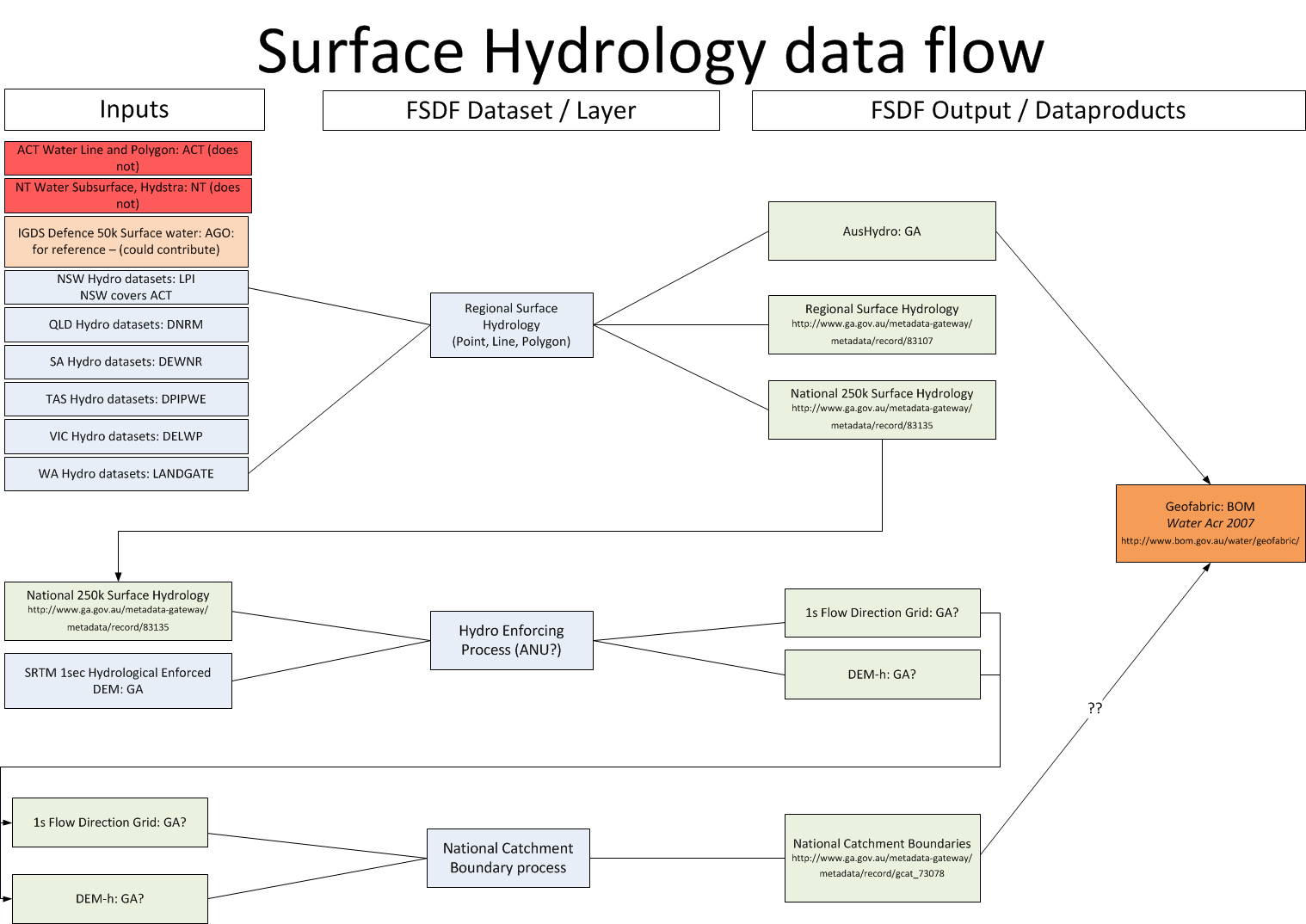
Australia’s rivers, lakes, water storages and catchments are all connected—and understanding these connections is vital for effective management of water resources. The Australian Hydrological Geospatial Fabric (Geofabric) provides a national framework for discovering, reporting and modelling water information.
The Geofabric is a digital database of surface and groundwater features that registers the spatial relationships between important hydrologic features.
The Geofabric is suitable for a wide range of water information applications. Streams can be traced upstream or downstream to identify drainage networks, catchment areas, and other features of interest such as monitoring points and water storages.
These features are used by natural resource managers and the Bureau for water accounting, assessment, modelling and forecasting. The Geofabric provides a standardised authoritative information source that works seamlessly across Australia. It enables efficient and repeatable spatial hydrological capability for streamflow analysis and creation of contributing catchment areas. Using the Geofabric also removes the need to process digital elevation model data.